

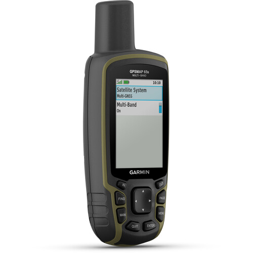
Garmin GPSMAP 65s best price in Kenya is Ksh 57,999. Your outdoor adventures, whether in the backcountry or a big city, will be safer and more enjoyable with the Garmin GPSMAP 65s Handheld Navigator. This feature-rich device employs five global navigation satellite systems—GPS, GLONASS, Galileo, QZSS, and IRNSS—for pinpoint positioning, even in heavy cover, mountainous terrain, or urban canyons. The built-in altimeter, barometer, and three-axis electronic compass will aid and inform your travels. The navigator comes pre-loaded with routable topo maps of the U.S. and Canada, and has a microSD card slot for uploading finely detailed Garmin Topo 24K or HuntView Plus maps. It provides access to automatic geocaching updates from from Geocaching Live, including descriptions, logs, and hints. Emails, texts, and alerts are displayed when the GPSMAP 65 is linked with a compatible smartphone or device.
Garmin GPSMAP 65s General Specification |
|
| PHYSICAL DIMENSIONS | 6.1 x 16.0 x 3.6 cm |
|---|---|
| DISPLAY SIZE | 3.6 x 5.5 cm; 2.6-inch diagonal (6.6 cm) |
| DISPLAY RESOLUTION | 160 x 240 pixels |
| DISPLAY TYPE | Transflective, 65K colour TFT |
| WEIGHT | 217 g with batteries |
| BATTERY TYPE | 2 AA batteries (not included); NiMH or Lithium recommended |
| BATTERY LIFE | 16 hours |
| WATER RATING | IPX7 |
| HIGH-SENSITIVITY RECEIVER | Yes |
| INTERFACE | High-speed mini USB and NMEA 0183 compatible |
| MEMORY/HISTORY | 16 GB (user space varies based on included mapping) |
Maps & memory |
|
| PRELOADED MAPS | Yes (TopoActive Africa) |
|---|---|
| ABILITY TO ADD MAPS | Yes |
| BASEMAP | Yes |
| AUTOMATIC ROUTING (TURN BY TURN ROUTING ON ROADS) FOR OUTDOOR ACTIVITIES | Yes |
| MAP SEGMENTS | 3,000 |
| BIRDSEYE | 250 BirdsEye Imagery files |
| INCLUDES DETAILED HYDROGRAPHIC FEATURES (COASTLINES, LAKE/RIVER SHORELINES, WETLANDS AND PERENNIAL AND SEASONAL STREAMS) | Yes |
| INCLUDES SEARCHABLE POINTS OF INTERESTS (PARKS, CAMPGROUNDS, SCENIC LOOKOUTS AND PICNIC SITES) | Yes |
| DISPLAYS NATIONAL, STATE AND LOCAL PARKS, FORESTS, AND WILDERNESS AREAS | Yes |
| STORAGE AND POWER CAPACITY | Yes (32 GB max microSD™ card) |
| WAYPOINTS/FAVOURITES/LOCATIONS | 5,000 |
| TRACKS | 200 |
| TRACK LOG | 10,000 points, 200 saved tracks |
| ROUTES | 200, 250 points per route; 50 points auto routing |
Sensors |
|
| GPS | Yes |
|---|---|
| GLONASS | Yes |
| GALILEO | Yes |
| QZSS | Yes |
| BAROMETRIC ALTIMETER | Yes |
| COMPASS | Yes (tilt-compensated 3-axis) |
| GPS COMPASS (WHILE MOVING) | Yes |
| MULTI-BAND FREQUENCY SUPPORT | Yes |
Daily smart features |
|
| SMART NOTIFICATIONS ON HANDHELD | Yes |
|---|---|
| VIRB® CAMERA REMOTE | Yes |
| COMPATIBLE WITH GARMIN CONNECT™ MOBILE | Yes |
Outdoor recreation |
|
| POINT-TO-POINT NAVIGATION | Yes |
|---|---|
| COMPATIBLE WITH BASECAMP™ | Yes |
| AREA CALCULATION | Yes |
| HUNT/FISH CALENDAR | Yes |
| SUN AND MOON INFORMATION | Yes |
| GEOCACHING-FRIENDLY | Yes (paperless) |
| CUSTOM MAPS COMPATIBLE | yes (500 custom map tiles) |
| PICTURE VIEWER | Yes |
Outdoor applications |
|
| COMPATIBLE WITH GARMIN EXPLORE™ APP | Yes |
|---|---|
| GARMIN EXPLORE WEBSITE COMPATIBLE | Yes |
Connections |
|
| WIRELESS CONNECTIVITY | Yes – Bluetooth®, ANT+® |
|---|---|
Buy Garmin GPSMAP 65s at the best price online in Kenya from Gadget Central Ltd.


